
The Saigon Riverfront Reborn: A Local’s Guide
For most of its modern life the Saigon River was someth […]

For most of its modern life the Saigon River was something you crossed, not somewhere you went. That has changed. In the space of a few years the banks on both sides have been rebuilt into parks, a river bus that locals actually ride home has found its rhythm, and a pedestrian bridge shaped like a coconut leaf is rising over the water. This guide covers the whole reborn waterfront: what is on each bank, how to move between them, where to eat with a river view, and how to spend one unhurried golden-hour afternoon along it, all within a short walk or ride of central District 1.
The riverfront at a glance. Main access point: Bạch Đằng Wharf, No. 2 Tôn Đức Thắng, District 1, about five minutes on foot from the Đồng Khởi area. Two facing parks, one river bus route, one pedestrian bridge under construction. Best hours: roughly 4pm to 8pm, dry season (November to March) for the most reliable evenings. Almost everything here is free to enjoy.
Table of Contents
Why the Saigon River is having a moment
The short answer is that the city finally turned to face its river. The Saigon River runs about 251 kilometres from Cambodia down through the city to the sea, and for decades the downtown stretch was working waterfront and traffic, not leisure. The opening of new public parks on both banks, along with the river tunnel and the Ba Son bridge, changed the geography of an evening out.
Young Saigon noticed first. On any dry-season evening the lawns fill with students, couples and families carrying iced coffee and takeaway dinners, staying until the towers across the water are fully lit. What was once a barrier down the middle of the city now reads as its longest, most open public space, and it is still gaining pieces year by year.
Bạch Đằng Wharf: the District 1 waterfront
Bạch Đằng is where most people meet the river, and the easiest riverside to reach on foot. The promenade sits at No. 2 Tôn Đức Thắng, running roughly 1,352 metres along the western bank across about 23,400 square metres of park. It is a five-minute stroll from the heart of Đồng Khởi, just past the Nguyễn Huệ pedestrian street, and it sits at the meeting point of Đồng Khởi, Hàm Nghi and Nguyễn Huệ.
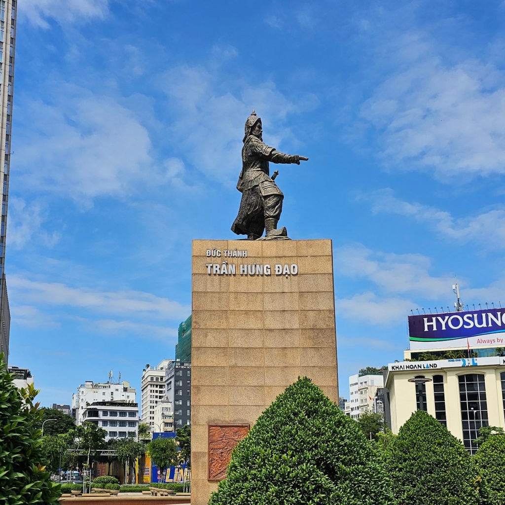
The landmark here is the statue of Trần Hưng Đạo, the general who twice repelled Mongol invasions, standing about six metres tall on a high triangular base with one hand pointing out over the water. By morning the promenade belongs to joggers and tai chi groups. After about five o’clock it turns into a gentle strip of snack carts, buskers and people sitting to watch the boats, with Landmark 81 glowing downstream.
Bạch Đằng is also the working heart of the river: the main wharf for the water bus, and the departure point for the dinner cruises that glide out after dark serving set menus under the city lights. If you only learn one riverside name before you arrive, make it this one.
The Thủ Thiêm riverside park: the far bank
Across the water, the eastern bank holds the city’s favourite open-air living room. The Saigon riverside park at Thủ Thiêm opened on 23 December 2023 and covers nearly 20 hectares along about 600 metres of bank, running from near the Ba Son bridge to the Thủ Thiêm tunnel. It is built around thirteen main components, including wide community lawns, a stone park, a fountain and a riverside love bridge, and it is open daily from about 6am to 10pm.
Because it faces straight back at the downtown towers, it draws its biggest crowds at sunset. The headline attraction is a seasonal sunflower field of roughly 5,000 to 6,000 square metres, planted to look across the water toward Bạch Đằng. Since May 2024 the park has also held D-Joy, an entertainment zone of nearly two hectares with more than twenty activities, from pickleball and drone racing to street carnival acts, giant kite-flying and food stalls.
The plantings and pop-up attractions change through the year, so it is worth a quick local check on what is on when you visit. Our companion guide to the Bạch Đằng and Thủ Thiêm parks walks through each bank in detail.
Riding the Saigon Water Bus
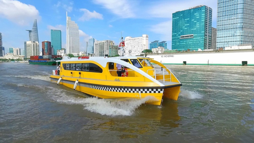
The nicest way to feel the river is from the middle of it. The Saigon Water Bus launched in November 2017 as a real commuter service, run by the operator Thường Nhật, and it doubles as one of the loveliest slow things to do in the city. The first route covers about eleven kilometres from Bạch Đằng upstream to Linh Đông in Thủ Đức, calling at a series of wharves including Bạch Đằng, Thủ Thiêm, Bình An, Thảo Điền, Thanh Đa, Hiệp Bình Chánh and Linh Đông (the stops in service have changed over time, so check the current list).
A single ride costs around 15,000 VND, about the price of a street coffee, bought per leg. Boats are covered and air-conditioned, and an evening service introduced in 2021 makes the sunset run possible. From the Bình An stretch the view opens toward Landmark 81, and many locals pair the boat with the train: metro out to Thảo Điền, then float home by water. We cover the whole thing in the water bus guide and map the loop in our Thảo Điền day-trip guide.
The coconut-leaf pedestrian bridge
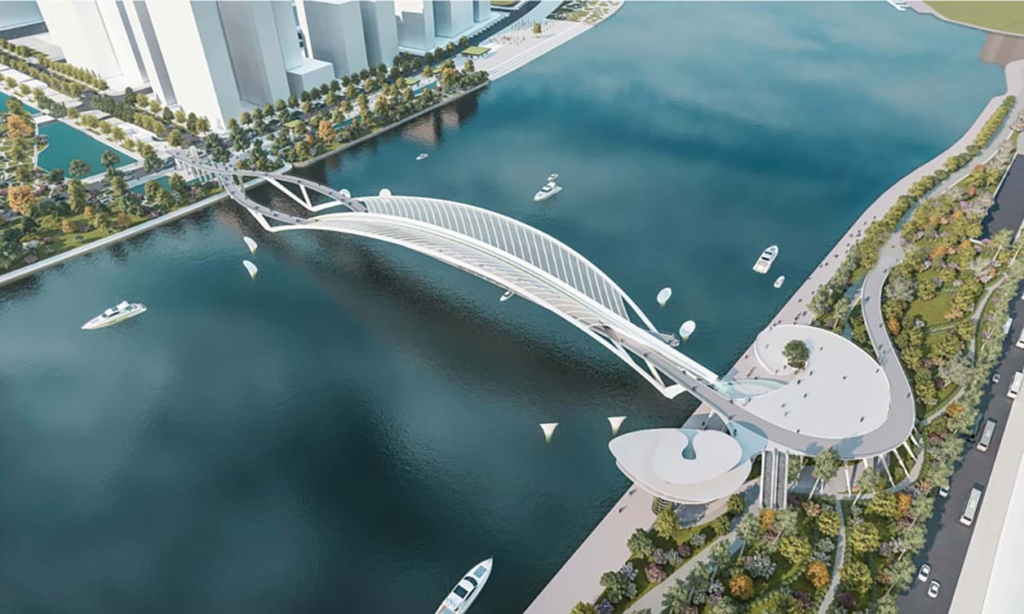
The piece that will tie the two banks together is still going up, and it is the one to watch. A pedestrian and cycling bridge about 720 metres long is being built to link Bạch Đằng directly with the Thủ Thiêm park, with a main span of 187 metres and a steel arch shaped like a water-coconut leaf, a symbol of southern Vietnam. It is designed by the Chodai and Takashi Niwa Architects team and funded in full by Nutifood, at close to 1,000 billion VND.
Construction began in early 2025, and recent reports have the project accelerating toward completion around National Day, 2 September 2026. Dates on works this size can still move, so treat that as a target rather than a promise and check locally near your visit. Once it opens, crossing the river on foot from the centre will take only a few minutes. We track progress in our pedestrian bridge update.
Where to eat and drink with a river view
The riverfront rewards an appetite. At street level, the Bạch Đằng promenade is lined with snack carts in the evening, from grilled corn and rice-paper skewers to fresh coconut. For something with a view and a tablecloth, the wharf is the departure point for Saigon River dinner cruises, which serve Asian and European set menus while the skyline slides past.
Higher up, the towers around the river hold some of the city’s best-known rooftop bars, where a sundowner comes with a long view over the water and the Thủ Thiêm bank. Book the earlier end of the evening for the sunset slot. For a full sit-down meal, the heritage streets just back from the water in District 1 are dense with options, many of them mapped in our self-guided District 1 walks.
A golden-hour afternoon along the river
If you have one free evening, here is the version we would do ourselves. Leave the centre around four o’clock, when the heat is easing, and walk down to Bạch Đằng past the Trần Hưng Đạo statue. Stroll the promenade, then catch the water bus upstream and ride it back so you are mid-river as the sun drops and the skyline lights up behind you.
Step off at Bạch Đằng into the evening crowd, pick up something from a snack cart, and either settle in for a river dinner cruise or walk back into District 1 for a sit-down meal. Prefer to stay on foot? Once the new bridge opens you will be able to cross straight to the Thủ Thiêm park for the sunflower field and the skyline view, then wander back the same way.
Practical tips for visiting the Saigon riverfront
- Getting there. From central District 1, Bạch Đằng is a five to ten minute walk. The Thủ Thiêm park is a short taxi ride across the Ba Son bridge or through the river tunnel, or a stop on the water bus.
- Best time. Late afternoon into early evening, with the best light between five and half past six. Dry season, November to March, gives the most reliable evenings.
- What to bring. A light layer for the breeze on the water, sun cover for late afternoon, and a little cash for snacks and boat tickets.
- Safety. Both banks are busy, family-friendly public spaces after dark. Keep an eye on your phone and bag while taking photos, and use a reputable taxi or ride-hailing app for the trip home.
Frequently asked questions
Where is the Saigon riverfront and how do I reach it?
The most accessible stretch is Bạch Đằng Wharf at No. 2 Tôn Đức Thắng, on the western bank at the foot of District 1. It is about a five-minute walk from the Nguyễn Huệ pedestrian street and the Đồng Khởi area, so from most central hotels you can simply walk. The Thủ Thiêm park sits directly opposite and is reached by a short taxi ride across the Ba Son bridge or the river tunnel, or by water bus, and on foot once the pedestrian bridge opens.
What is there to do along the Saigon River?
Walk the Bạch Đằng promenade past the Trần Hưng Đạo statue, ride the water bus at sunset, and cross to the Thủ Thiêm riverside park for its sunflower field, love bridge and the D-Joy activity zone. In the evenings the banks fill with street snacks and buskers, dinner cruises depart from Bạch Đằng, and during Lunar New Year the Thủ Thiêm side hosts a large spring flower market.
How much does the Saigon Water Bus cost and where does it go?
A single trip is around 15,000 VND, bought per leg. The route runs about eleven kilometres from Bạch Đằng in District 1 upstream to Linh Đông in Thủ Đức, stopping at a series of wharves including Bạch Đằng, Thủ Thiêm, Bình An, Thảo Điền, Thanh Đa, Hiệp Bình Chánh and Linh Đông (stops can change, so check the current list). Most visitors board and return at Bạch Đằng, the closest wharf to the centre.
When will the new pedestrian bridge over the Saigon River open?
The coconut-leaf pedestrian bridge linking Bạch Đằng and Thủ Thiêm began construction in early 2025, and recent reports point to completion around National Day, 2 September 2026. Timelines on large projects can shift, so it is worth checking locally when you visit. Once open, it will let you walk between the two banks in a few minutes.
What is the best time of day and year to visit?
Late afternoon into early evening, with the best light between five and half past six and the promenades liveliest once the sun is down. Dry season, from around November to March, gives the most reliable evenings, though the riverside is pleasant year round outside of a passing shower.
Is the Saigon riverfront free to visit?
Yes. The Bạch Đằng promenade and the Thủ Thiêm park are open public spaces that are free to wander. You only pay for what you choose, such as street snacks, a coffee, a water bus ticket at around 15,000 VND, or a seat on a dinner cruise.
Can I reach Thảo Điền or Thủ Thiêm along the river?
Yes. Thảo Điền is a popular half-day trip that many people now do as a loop: metro out on Line 1, then the water bus back downtown along the river. Thủ Thiêm, on the eastern bank facing District 1, is reached by taxi or the river tunnel today, and on foot once the pedestrian bridge opens.
Is the riverfront safe in the evening?
The Bạch Đằng promenade and the Thủ Thiêm park are busy, family-friendly public spaces in the evenings and are generally very comfortable after dark. As anywhere with crowds, keep an eye on your phone and bag, especially while taking photos, and use a reputable ride-hailing app or taxi for the trip home.
Want to wake up five minutes from the river?
The Myst Đồng Khởi is a 108-room boutique heritage hotel in the quietest corner of District 1, a five-minute walk from the Saigon River and four from the Nguyễn Huệ Flower Street. Inducted into the Michelin Guide Hotels and Stays selection and named 2025 World Luxury Hotel Awards Country Winner for Vietnam, it is a calm base for slow riverside evenings and an easy walk home afterwards.
→ Book direct for our best rate
Crafted by Silverland Hotels.
Others

Marseille Roof Tiles: From the Clay Pits of Marseille to the Roofs of Saigon
In 2004, when a few ...
The Ba Son Shipyard: Two Centuries on the Saigon River
Ride Saigon’s ...
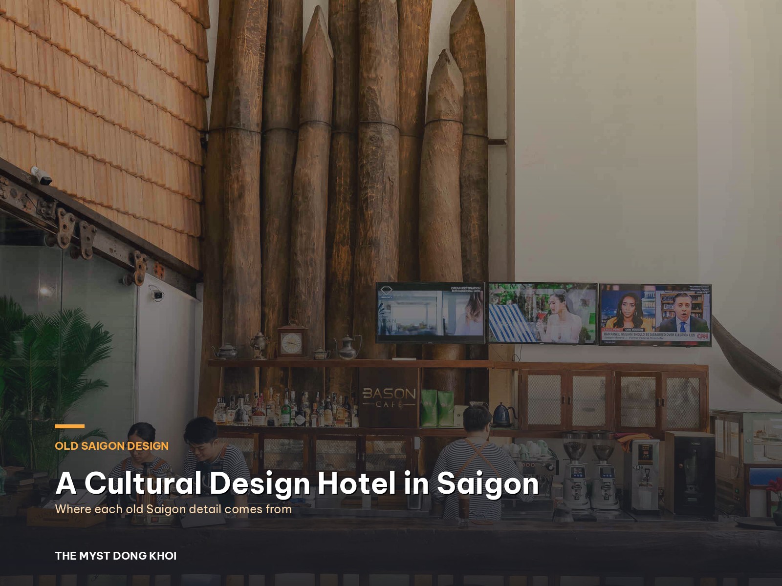
Old Saigon, detail by detail: inside a cultural design hotel Saigon can call its own
Turn off Đồng Khởi i...
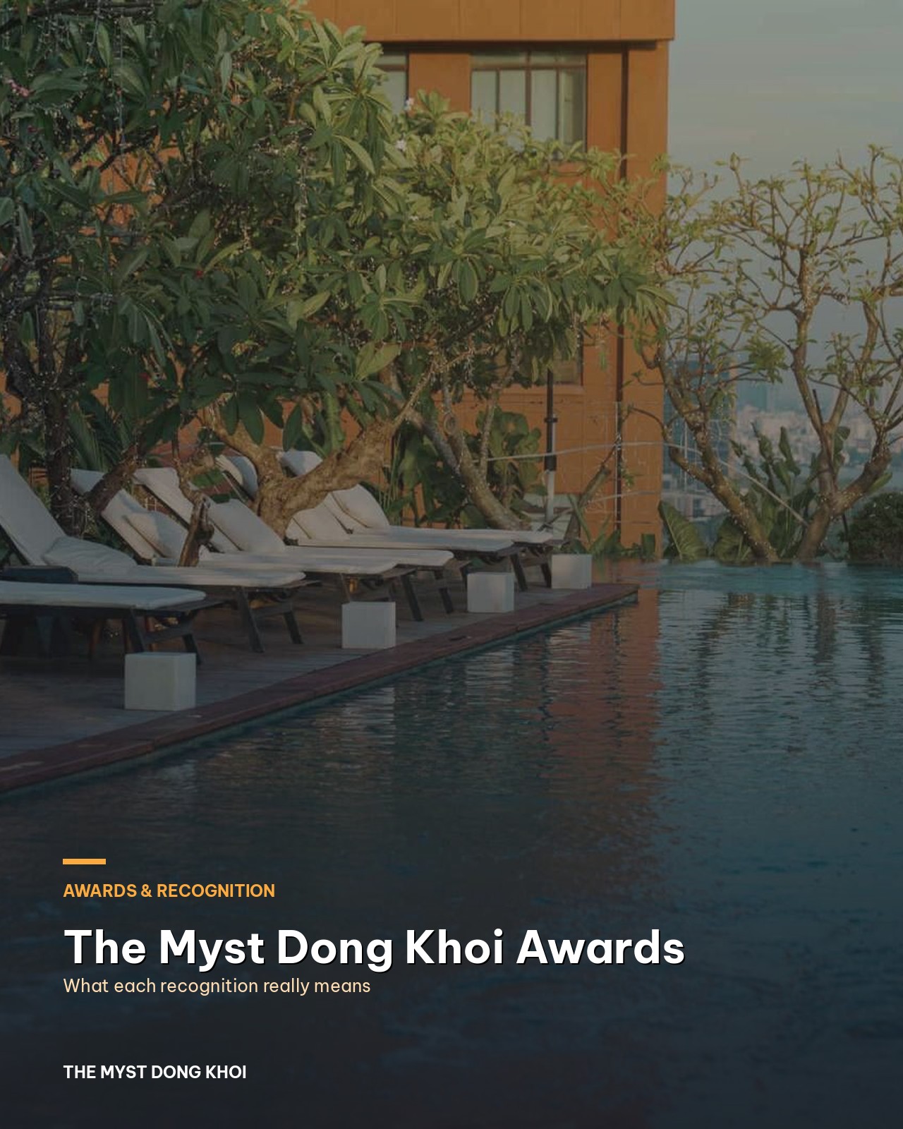
The Myst Dong Khoi awards: what each recognition tells you before you book
Stand on Hồ Huấn Ngh...

What Is a Cultural Luxury Hotel? How to Spot One Before You Book
It is eleven at nigh...

Wedding Color Palette 2026 and 2027: Six Schemes to Love
Color is the first d...